
Mkalama District Council was established in July, 2012. This is one of the newly established councils which are in line with the Government commitment of ensuring that provision of goods and services is brought closer to the beneficiaries, i.e. local people. Mkalama District Council was therefore born after having divided the former Iramba District Council into two independent Councils namely Mkalama and Iramba District Councils.
Mkalama District Council is one among seven councils forming Singida Region namely Singida District Council, Manyoni District Council, Singida Municipal Council, Iramba District Council, Ikungi District Council and Itigi District Council.
Geographical Location
Mkalama is situated in the North of the region between latitudes 4o and 4.30o south of the Equator and longitudes 34o and 35o east of Greenwich Meridian. The district is divided into three major zones, the eastern low land and the central – lowlands. The central zone is covered with hills and plateau with an altitude of 1,000m to 1,500m above sea level, with sandy loam soils. The eastern zone comprises lowlands along the Great Rift Valley with scattered hills with red, black and sandy loam soils. It mounts have altitude of 1,000m to 1,500m above sea level.

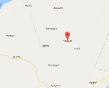
The map of Singida dc showing Mkalama DC.
MKALAMA DISTRICT COUNCIL
Anuani ya Posta: P.o. Box 1007
Simu ya Mezani: 026-2964005
Simu ya Mkononi: +255 758 954 045
Barua pepe: ded@mkalamadc.go.tz